Contributing to OpenStreetMap part 2: Gathering data on the field
Written by Paul Kocialkowski no commentsI could keep writing a lot about the ideas behind the project, my personal motivation and such but well, OpenStreetMap is one of the rare projects I'm contributing to that actually require people to get out and see things for themselves ! So that's very good for us hackers that are used to do our work behind a screen: for once, we're required to get some fresh air. That has been a good opportunity for me to discover more of the city where I live, do some sports by the way and discover many relaxing places in a natural environment.
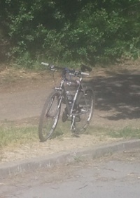
From the moment I started mapping, I always used a bike to move around town. That's probably the best way to catch every detail surrounding your ride, making it easy to stop at any moment and any place. I've done mapping on my feet a couple time too, it's good when there is a high-density of POI (Points Of Interest), like in the town centre. If this is not the case where you live, you are most likely going to waste a lot of valuable time. On the other hand, this can be a fun way to spend some hours to kill in the middle of the day.
The first device I used to do mapping was the Neo FreeRunner and its embedded GPS. I also got an external antenna to improve the reliability of the traces. On the software side, I was most of the time using Hackable:1 and TangoGPS but at some point switched to SHR with FoxtrotGPS. That was pretty nice to use, except that the keyboard with very small and required me to carry a pen. I attached the FreeRunner to my bike using cable ties though I had to drive very carefully to avoid damaging the phone.

Carrying a sheet of paper and a pen can also turn out to be very useful to draw a quick sketch of the ways and their names. When possible, printing walking papers (black and white is fine) with the already mapped OSM informations helps a lot too. I'm not a regular user of these methods but from time to time it helps, especially when there is not a lot of informations already available on OSM. Another kind of complementary mapping technique that I used from time to time is voice recording: this permits to be very precise in the description. These techniques are used best along with regular GPS tracking.
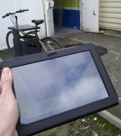
As soon as all the streets were properly tagged, I focused on adding particular POI such as stores, bus stops, public buildings, etc. Thanks to the Cadastre, we have the detail of every building available in OSM, so we can precisely place POI without the need of GPS traces. The FreeRunner remains relevant for this task but just as well as other devices. At some point, I decided to switch to Android devices to map (with the OsmAnd app, that is free software). Since most of these devices come with a camera, it also permits to take pictures of the place quickly while mapping. A phone is fine for that, but the best I've found is a tablet with a large screen: you can place the POI precisely that way and enjoy the large keyboard. OSM mapping is one of the tasks you'll really enjoy doing with a tablet more than any other device.